

Daily London
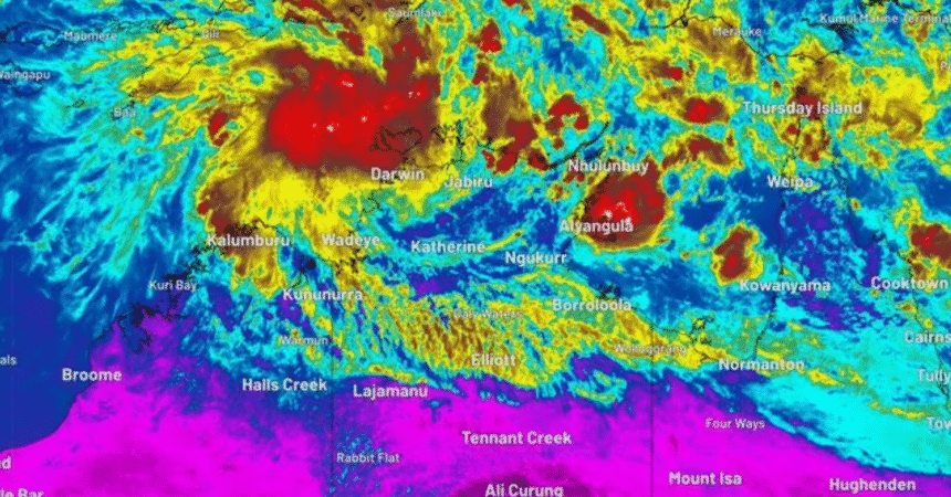
A tropical low is currently developing over the Timor Sea.
It is moving away from Australia but the Bureau of Meteorology believes it is likely to turn south and then south-west on Thursday, toward the NT coast.
“Environmental conditions are favourable for development of (tropical low) 02U and the risk the low develops into a tropical cyclone increases as the week progresses,” the Bureau’s cyclone forecast said this morning.
“Although there remains high variability in model intensity ranges, there is increasing risk that 02U could become a tropical cyclone on Wednesday or Thursday.”
The Bureau currently rates the chances of a cyclone developing at 60 per cent between 11 pm Thursday and 11 am Friday.
But the possibility remains over 50 per cent from tomorrow night, through to next Monday, which BoM calculates as a “high” risk level.
“At this early stage in the system’s development, it is difficult to predict exactly where it will move and how strong it will get.
“However, there is enough consensus between forecast models for residents in the Top End and Kimberley to pay close attention to the latest tropical cyclone forecasts and advisories for the most up-to-date information over the coming week.”
Residents in those regions are urged to stay on top of weather updates and prepare their emergency plan.
While Australia’s tropical cyclone season runs from November to April, it’s rare to see one develop this early.
Weatherzone said only four cyclones in recorded history had made landfall on the Australian mainland in November, with the most recent being Tropical Cyclone Alessia in 2013.
Last month, the Bureau of Meteorology revealed the first cyclone to develop in the Australian region in the 2025-2026 season would be named Fina.