

Daily London
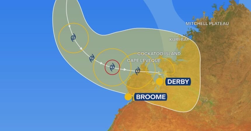
Tropical Cyclone Hayley is a category one system that is about 535 kilometres from the mainland, and is strengthening as it moves south.
It’s current trajectory shows it moving in a south-easterly direction, putting it close to the towns in the state’s north, and could reach category two later today.
Winds near the epicentre are sitting at 85km/h, with gusts reaching up to 120km/h.
Wind gusts could reach up to 140km/h on the coastal fringe north of Brome late on Tuesday.
Heavy rainfall is also expected in the region, leading to risk of flash flooding, the BOM warns.
Up to 20mm of rain is expected to fall in Broome, though this could increase depending on how close Cyclone Haley gets to the town itself.
The town of Derby could also be in the eye of the storm, with 35mm of rain expected tomorrow, and 10mm more on Wednesday.
The BOM is urging residents in the warning zone to prepare a plan and to monitor the Emergency WA website for updates.