
Daily London
It’s the first cyclone of the season, and could potentially make a historic landfall over the next few days.
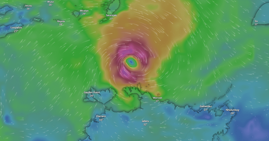
Fina is currently a category 1 cyclone and has been rapidly intensifying off the north north-east coast of the Northern Territory much faster than expected, the Bureau of Meteorology has said.
The cyclone is sitting around 370km from the coast and most of the severe weather is being felt closer to the eye of the storm.
However, later this evening, Fina is expected to move towards the east north-east coast of the NT and will reach a category two intentity.
Fina is then expected to make a U-turn, hooking south and then moving south-west to the NT’s northern coastline.
Late tomorrowevening into Friday is when direct impacts will be felt on the NT coast.
“In this Tropical Cyclone Watch area, we’re likely to see gale-force winds developing within the next 48 hours,” said Senior Meteorologist Miriam Bradbury.
“For some areas that might be as early as tomorrow, but for others we might not see that gale-force wind developing until Friday morning.
“In fact, we may even see some locally destructive wind gusts up to 135 km/h developing for parts of the Northern Territory coastline between Cape Don and Warruwi through late Thursday into early Friday.”
Residents in Darwin have been urged to remain vigilant as Fina edges closer to the coast on the weekend.
The worst of the impact will be felt in Darwin over the weekend, including gale-force winds, storm surges and heavy rainfall.
Fina is fast-moving and unpredictable, the bureau said.
Several different scenarios could play out however residents on the NT coast have been told to brace for some severe weather.
As of 3.30am ACST (5am AEDT, 4am AEST), the category one cyclone had sustained winds of 75km/hr and gusts of up to 100km/hr.
It was about 315km north-east of Darwin and moving at about 9km/hr.